Context data layers
When drawing the project on the underlying map, there are several layers that can be toggled to provide context for the project:
Location condition
Once a project area is drawn, the project area is intersected with several layers to present a summary of the pre-project (initial) conditions. These are grouped under several headings:
General
A collection of measures to provide context for the project location.
- Project area: based on the project polygon/s
- Catchment: based on a Truii-derived catchment name layer
- Natural resource management region: based on NRM Australia produced NRM region layer
- Bioregion: federal government IBRA bioregion layer and bioregion description
- Average annual rainfall: Analysis of the Qld Government produced SILO 70-year rainfall record (1950-2019 inclusive) corresponding to the project centroid
- Seasonal rainfall classification: From the Bureau of Meteorology seasonal rainfall classification 1991-2020
- Local government area: Australian Bureau of Statistics published Local Government boundaries
Environment
A collection of measures to place the project site in context of the surrounding area (land uses and terrain) and environmental characteristics of the project site. The relative improvement in environmental conditions will be measured against these baseline conditions.
- Land uses: land use for a 25-kilometre radius using Catchment Scale Land Use of Australia (2023) aggregated into simple classes. (source: https://data.gov.au/data/dataset/catchment-scale-land-use-of-australia-and-commodities-update-december-2023)
- Terrain: Land slope for a 25-kilometre radius using Gallant and Austin (2012), Slope derived from 1″ SRTM DEM-S. v4. (https://doi.org/10.4225/08/5689DA774564A)
- Vegetated area: Landsat landcover classes for a 25-kilometre radius using (primarily) Geoscience Australia (DEA) Land Cover (see data description in 3.1, Context Data Layers)
- Soil Erodibility: Soil erodibility classes for a 25-kilometre radius (Soil erodibility classes derived from a continental scale representation of ‘K Factor’ for the Universal Soil Loss Equation. Soil properties sourced from the Soil and Landscape Grid of Australia (Organic Carbon and Sand, source https://esoil.io/TERNLandscapes/Public/Pages/SLGA/index.html ) and ASRIS (Australian Soil Classification and Hydraulic Conductivity, source https://data.csiro.au/collection/csiro:62790)
- Pollutant loads generated by hillslope erosion: Spatially averaged for the project site, the sediment and nutrient loads generated by hillslope erosion have been calculated applying a long-term average Revised Universal Soil Loss Equation (RUSLE) model. The RUSLE model has used a continental scale ‘K Factor’ (see data description in 3.1, Context Data Layers), ground cover averaged for 10 representative seasons, and slope and climate inputs as per the Truii hillslope erosion service. The RUSLE estimated (total) sediment mass is apportioned to Fine Sediment, Total Nitrogen and Total Phosphorus loads using particle size and soil nutrient concentration layers (surface, 5-15cm) of the Soil and Landscape Grid of Australia (https://esoil.io/TERNLandscapes/Public/Pages/SLGA/index.html)
- Regional agricultural carbon emissions per year: This represents enteric emissions as CO2 equivalent and uses a combination of finer resolution Land Use Trade Off Model Input Data (Bryan et al. 2021, https://data.csiro.au/collection/csiro:52373), and the coarser Global Ruminant Methane emissions(Herrero et al. 2013, https://data.csiro.au/collection/csiro:29893?q=livestock&_st=keyword&_str=40&_si=1) where there is no finer resolution coverage.
- Habitat condition for biodiversity: using the 2018 estimate of habitat condition provided by CSIRO-developed HCAS (base model estimation of habitat condition for terrestrial biodiversity, ecosystem site condition, annual epochs and 18-year trends for continental Australia, Harwood et al. 2023) CSIRO developed habitat condition assessment system (HCAS)
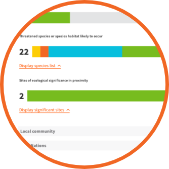
- Threatened species or species habitat likely to occur: Australia – ecological communities of national significance distributions supplied by the Australian Government (https://fed.dcceew.gov.au/datasets/3ce27fab85194f468bcfb106e5be15ee).
- Sites of ecological significance: Ramsar wetlands supplied by the Australian Government (https://fed.dcceew.gov.au/datasets/75555c9204414445ac88ca7894de0273_0).
Local community
Community based measures from the Australian Bureau of Statistics which quantify the baseline condition and opportunities of the region. The project demographics will be measured against these regional scores for determining relative improvement.
- Socio-economic advantage: uses the Index of relative socio-economic advantage and disadvantage (IRSAD) supplied by the Australian Bureau of Statistics (SA2 level) (range standardised to 0-100)
- Education and occupation: Index of education and occupation (IEO) supplied by the Australian Bureau of Statistics (SA2 level) (range standardised to 0-100)
- Economic resources: Index of economic resources (IER) supplied by the Australian Bureau of Statistics (SA2 level) (range standardised to 0-100)
- Eligible people in the workforce: Percentage of persons 15+ years in the workforce or studying (SA2 level) supplied by the Australian Bureau of Statistics.
- Employment diversity by age: Percentage of persons 15+ years in the workforce or studying by age (SA2 level) supplied by the Australian Bureau of Statistics.
- Employment diversity by gender:
- Percentage of persons 15+ years in the workforce or studying by gender (SA2 level) supplied by the Australian Bureau of Statistics.
- Managerial employment diversity by gender: Percentage of persons in the workforce or studying in managerial positions by gender (SA2 level) supplied by the Australian Bureau of Statistics.
- Gender pay gap: Personal income in Australia (SA2 level) supplied by the Australian Bureau of Statistics.
First Nations
The relevance of the project for First Nations people is captured firstly by whether the project occurs within the indigenous estate (more likely to have on-country value) and in terms of how First Nations peoples are employed in the project.
- Proportion of project area within the indigenous estate: Percentage of the project area that spatially intersects weighted classifications of the indigenous estate supplied by the Australian Government (https://www.agriculture.gov.au/abares/forestsaustralia/forest-data-maps-and-tools/spatial-data/indigenous-land-and-forest)
- Proportion of First Nations peoples engaged in the workforce: First Nations people 15+ years in the workforce, compared to total workforce 15+ years supplied by the Australian Bureau of Statistics.
- First Nations employment gap: The difference between First Nations people 15+ years in the workforce and all others 15+ years in the workforce derived from data supplied by the Australian Bureau of Statistics.